Historical mapping information
| This is available if your company has paid for the Historical GPS Tracking feature.
This is a standard feature for Queensland School Ticketing - QST. |
- Login to Transportme™ or QST or TfNSW operator portal.
- Select the GPS Tracking tab on the top menu.
- Select Historical Mapping Information tab from the drop down or the left hand menu.

-
- Example of the page of Transportme™ and TfNSW operators.
- Example of the page of QST operators.


- Step 1 - Filter data to run the report:
- Choosing the date range Date Range From and Date Range To date picker;
- Choosing Route Category and Route Name from the dropdown list.
- Note: if Include Historical Data option is selected, deleted data such as deleted routes may be searched and displayed in the result.
- Select the Generate historical mapping information button to generate the report.
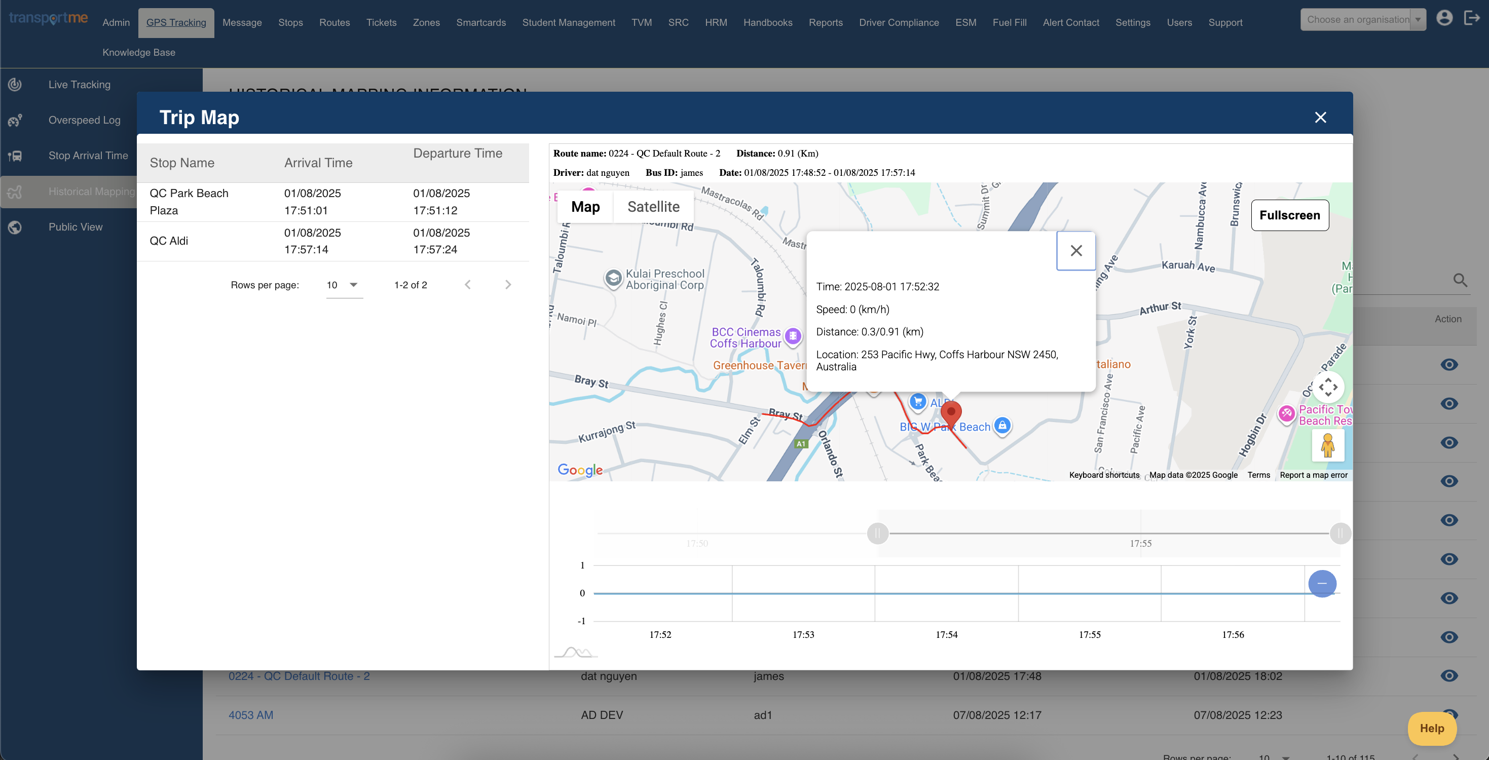
- Step 2 - Choose trip to show on the map:
- Locating the trip you wanted to check the historical mapping information by the Bus Number and Route Start Time
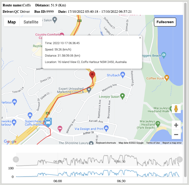
- Selecting the Info button for Transportme™ and TfNSW operators or Show on a map button for QST operators. On the map, the user can drag the pin along the route and it will display the time, speed and distance at any point.
Operating on the map:
- Fullscreen button: allows the map to be viewed on the Operator Portal as a full screen version.
- Zooming in or out the map to view the historical route line of the selected route - the red line on the map.
- Checking detail of any location on the route line by clicking that point or drag and drop the red pin.
- The graphs under the map allow the user to identify what time the bus was at any given location on the route and at what speed.